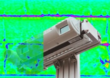
The XenoTrack 6D Road LiDAR from XenomatiX is an advanced lidar system that digitises the pavement and generates a digital 6D model of the road surface. It automatically calculates the quality indices and extracts all types of cracks and surface distresses with millimetre-level accuracy.
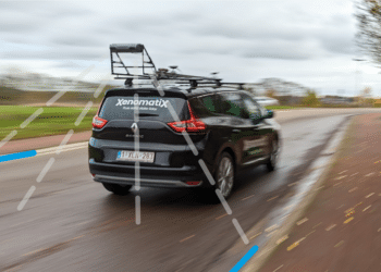
The system stands out for its performance, user-friendliness and its price. XenoTrack is a lightweight and compact system, easy to transport – even by plane – and can be installed on virtually any vehicle. This makes it an ideal solution for surveyors and road managers who are often on the move. Installation requires only one person and takes around 45 minutes before it is ready to collect and inspect the pavement.
During a single drive at normal traffic speed, XenoTrack captures data across the full road width and operates seamlessly in start-and-stop conditions. This represents a true change compared to traditional road inspection systems.
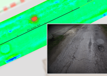
The collected data is automatically processed overnight. All results are accurately georeferenced and made available to upload on a GIS or other platform. This allows users to decide on the required repair, prepare a budget and follow-up over time.
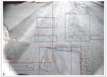
The XenoTrack system is iCART and NCART certified, ensuring compliance with international road assessment standards. XenoTrack accurately measures and automatically calculates all key pavement indices. These include the International Roughness Index (IRI – AASHTO 56, ASTM 950, EN 13036-5 and ASTM E1926), Rutting (ASTM E1703, EN13036-8), Pavement Condition Index (PCI – ASTM D6433) and Mean Profile Depth (MPD – ASTM E1845). Additionally, it automatically detects and locates cracks (ASTM E3303), potholes and patches – all very useful when building a detailed repair plan.
To address diverse needs and budgets, XenoTrack is available in different configurations, ranging from an accessible entry-level to a fully equipped high-performance configuration. The entry-level package is designed for early-stage monitoring and smaller networks, providing a cost-effective way to start collecting objective road condition data. As needs evolve, the system can be scaled and upgraded recovering the previous investment and allowing users to add advanced sensing and additional analysis capabilities step-by-step.
All packages share the same core advantages – they are built on true solid-state LiDAR technology. It offers fast installation, full vehicle flexibility, reliable start-and-stop operation, accurate georeferencing, automated data processing and certified data quality output. This modular approach ensures that XenoTrack grows with the user’s ambitions, delivering reliable insights at every stage of your road asset management.
Watch this short video below about how XenoTrack operates.
Content produced in association with XenomatiX