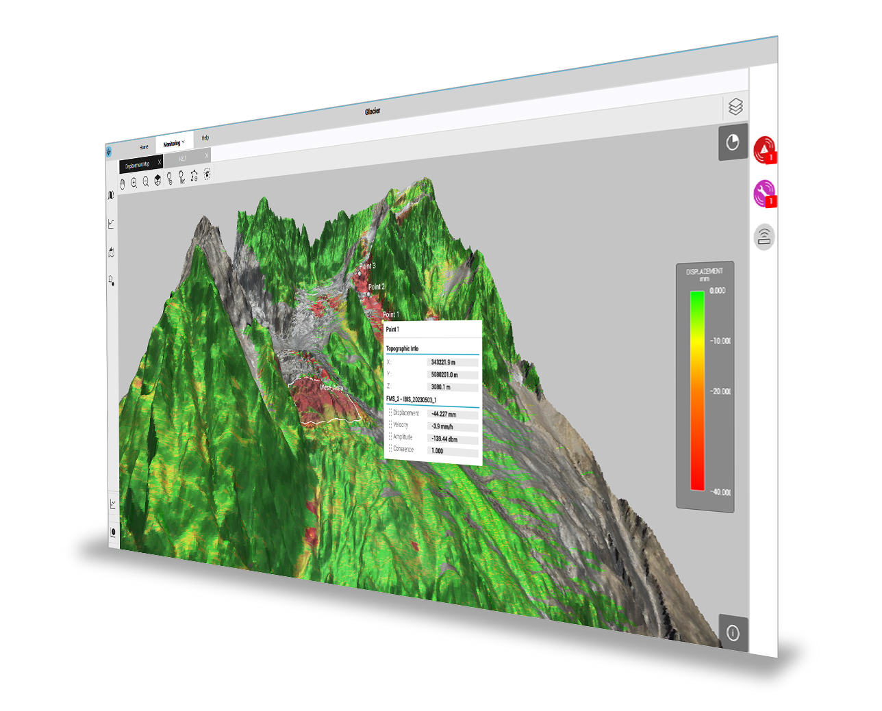
Hexagon says that its new GeoMonitoring package provides a web-based safety monitoring platform. Powerful, 3D visualisations of the monitored environment are at the core of the platform, offering access to data and charts in just a few clicks. This view of monitoring data enables geotechnical engineers and geologists to manage the full monitoring cycle – from field data collection to interpretation.
Landslides and ground deformation can cause significant damage to urban areas and critical infrastructure such as roads. The new web platform’s visualisation and analysis tools deliver actionable insights for early safety interventions that protect people and high-value assets.
GeoMonitoring combines an interface with data ingestion and management, collaborative analysis tools, and automatic intelligent alerts. Its view of the environment helps users identify displacement patterns, understand correlations, and detect anomalies – making insights more accessible to non-experts and supporting better decision-making.
Up-to-date IT security standards and enhanced user management features in the GeoMonitoring platform enable multiple stakeholders to work within the same secure project environment. These features include secure data transmission with encrypted communication, protected user access and multi-user profiling.